I followed the GR5 for most of the route, apart from the GR55 through the Vanoise, the GR5B variant before Briancon, and the GR52 to finish at Menton via the Mercantour national park.
Sunday, July 15, 2012
Saturday, July 14, 2012
The Schedule
I've now completed this trip.
The final stats were around 630km with 33,000 metres of ascent, in 15 days.
Day 1 - Friday 29th June
10:25 flight from Edinburgh to Geneva. 15:47 train to St Gingolph via St Maurice.
Started hiking at 6:18pm and made it to Refuge de Bise.
Distance 12km
Day 2 - Saturday 30th June
Made it to Samoens. Stayed at Hotel Gai Soleil.
Distance 52km
Day 3 - Sunday 1st July
Made it to Chamonix, and stayed at Hotel Le Chaumiere. Cold, wet and rainy in the afternoon.
Distance 43km
Day 4 - Monday 2nd July
Stayed at Refuge Plan de la Lai. Cold, wet and rainy in the afternoon.
Distance 48km
Day 5 - Tuesday 3rd July
Refuge Entree le Lac above Landry.
Distance 50km
Day 6 - Wednesday 4th July
Refuge Roc de la Peche after Pralognan. Cold, wet and rainy in the afternoon.
Day 7 - Thursday 5th July
Refugie I Re Magi (Three Wise Men) after Valfrejus above Modane.
Day 8 - Friday 6th July
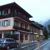
Briancon. Hotel Le Parc.
Day 9 - Saturday 7th July
Ceillac - Gite d'Etape.
Day 10 - Sunday 8th July
Larche - Gite d'Etape.
Day 11 - Monday 9th July
Auron. Hotel L'Oustelet.
Day 12 - Tuesday 10th July
Rimplas Hotel.
Day 13 - Wednesday 11th July
Refuge Madone de Fenetre. Busy.
Day 14 - Thursday 12th July
This was a short little outing of 6h30m from Madone de Fenetre to the Refuge des Merveilles, via Refuge de Nice through some pretty dramatic scenery. I arrived at Merveilles by 1pm, and then dossed around all afternoon It was just as well I had a reservation, since the refuge was fully booked.
Day 15 - Friday 13th July
The final day began at dusk just before 5:30am, and I arrived at Menton in baking heat just before 5:30pm.
Distance 52km.
The final stats were around 630km with 33,000 metres of ascent, in 15 days.
Day 1 - Friday 29th June
10:25 flight from Edinburgh to Geneva. 15:47 train to St Gingolph via St Maurice.
Started hiking at 6:18pm and made it to Refuge de Bise.
Distance 12km
Day 2 - Saturday 30th June
Made it to Samoens. Stayed at Hotel Gai Soleil.
Distance 52km
Day 3 - Sunday 1st July
Made it to Chamonix, and stayed at Hotel Le Chaumiere. Cold, wet and rainy in the afternoon.
Distance 43km
Day 4 - Monday 2nd July
Stayed at Refuge Plan de la Lai. Cold, wet and rainy in the afternoon.
Distance 48km
Day 5 - Tuesday 3rd July
Refuge Entree le Lac above Landry.
Distance 50km
Day 6 - Wednesday 4th July
Refuge Roc de la Peche after Pralognan. Cold, wet and rainy in the afternoon.
Day 7 - Thursday 5th July
Refugie I Re Magi (Three Wise Men) after Valfrejus above Modane.
Day 8 - Friday 6th July
Briancon. Hotel Le Parc.
Day 9 - Saturday 7th July
Ceillac - Gite d'Etape.
Day 10 - Sunday 8th July
Larche - Gite d'Etape.
Day 11 - Monday 9th July
Auron. Hotel L'Oustelet.
Day 12 - Tuesday 10th July
Rimplas Hotel.
Day 13 - Wednesday 11th July
Refuge Madone de Fenetre. Busy.
Day 14 - Thursday 12th July
This was a short little outing of 6h30m from Madone de Fenetre to the Refuge des Merveilles, via Refuge de Nice through some pretty dramatic scenery. I arrived at Merveilles by 1pm, and then dossed around all afternoon It was just as well I had a reservation, since the refuge was fully booked.
Day 15 - Friday 13th July
The final day began at dusk just before 5:30am, and I arrived at Menton in baking heat just before 5:30pm.
Distance 52km.
Friday, July 13, 2012
Day 15 - Refuge des Merveilles to Menton
Distance: 45km, Ascent: 1910m, Descent: 3940m, Time: 11h30m
After hanging around all yesterday afternoon at Refuge des Merveilles, I was glad to be on the move again.
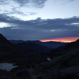
I had by now pretty much mastered the art of slipping out of the communal dorm at 5am, without making a sound. A flask of coffee and some bread and jam were waiting for me downstairs in the boot room. By 5.30am I was on my way, the dark night sky showing a faint strip of red on the horizon.
Luckily the path was pretty easy to follow in the half-light conditions, and I was soon at Pas du Diable 2436m. For here it is more or less downhill all the way to Sospel, with just a few minor re-ascents along the ridge. The route did require a bit of concentration, since the path would twist and turn from one side of the ridge to the other, or occasionally follow the high ground on the crest of the ridge. Eventually I was on the long final descent to Sospel, scattered with a few interesting remains of old artillery barrels. Just before reaching Sospel I made a wrong right turn down a mountain bike descent, and found myself skittering down a dusty trail almost too steep to maintain any footing.
Once at Sospel, I took a few minutes to grab some food and drink, before launching into the final climb up and over the steep wooded hills between Sospel and Menton. Partly because of the trees, and partly because of the heat, this section felt much longer than I was expecting, and there was a real sting in the tail with the last climb to Col du Berceau. There was great view across the Mediterranean from here, but also an extremely steep 1,100m descent to contend with in scorching heat.
When I finally reached street level in Menton after a frazzling descent, I wandered along past the marina then found the first available section of beach to go for a swim in the sea. Something I never managed to do at the end of either of my Pyrenean crossings.
View GR5 - Stage 15 in a larger map
 |
| GR5 - Day 15 |
I had by now pretty much mastered the art of slipping out of the communal dorm at 5am, without making a sound. A flask of coffee and some bread and jam were waiting for me downstairs in the boot room. By 5.30am I was on my way, the dark night sky showing a faint strip of red on the horizon.
Luckily the path was pretty easy to follow in the half-light conditions, and I was soon at Pas du Diable 2436m. For here it is more or less downhill all the way to Sospel, with just a few minor re-ascents along the ridge. The route did require a bit of concentration, since the path would twist and turn from one side of the ridge to the other, or occasionally follow the high ground on the crest of the ridge. Eventually I was on the long final descent to Sospel, scattered with a few interesting remains of old artillery barrels. Just before reaching Sospel I made a wrong right turn down a mountain bike descent, and found myself skittering down a dusty trail almost too steep to maintain any footing.
Once at Sospel, I took a few minutes to grab some food and drink, before launching into the final climb up and over the steep wooded hills between Sospel and Menton. Partly because of the trees, and partly because of the heat, this section felt much longer than I was expecting, and there was a real sting in the tail with the last climb to Col du Berceau. There was great view across the Mediterranean from here, but also an extremely steep 1,100m descent to contend with in scorching heat.
When I finally reached street level in Menton after a frazzling descent, I wandered along past the marina then found the first available section of beach to go for a swim in the sea. Something I never managed to do at the end of either of my Pyrenean crossings.
View GR5 - Stage 15 in a larger map
 |
| Stage 15 - Refuge de Merveilles to Menton |
Thursday, July 12, 2012
Day 14 - La Madone de Fenestre to Refuge des Merveilles
Distance: 14km, Ascent: 1360m, Descent: 1150m, Time: 6h30m
Day 14 was really just a short half-day to get to Refuge des Merveilles to be in position to reach the Med at Menton the following day. The hiking was fantastically scenic, although it did get horribly mobbed the closer I got to Vallee des Merveilles.
Given that I didn't need to make an early start, I left La Madone de Fenestre at 6:56am, my latest start on the whole trip. The hiking was high quality over Pas du Mont Colomb, past Refuge de Nice, and then over the last 2 high passes Baisse du Basto 2693m and Baisse de Vlmasque 2549m.
I reached Refuge des Merveilles by 1:30pm, and so had a very long afternoon hanging around, with not much to do apart from hanging up my washing. The evening was crazy, the place crowded to the gunnels. The evening meal was arranged in 2 sittings, due to the overcrowding. Luckily I was on the first sitting, but there was barely enough food to go around. I had my first sociable evening since Larche, and again my dining companions were Dutch. In fact I don't remember meeting any Brits on the trip.
After the meal we ordered more coffee and chocolate, and carried on chatting outside for a while before retiring upstairs to the completely crammed dormitory. I checked, double-checked and re-checked that I had everything packed and ready for a quick and silent 5am departure the next morning.
View GR5 - Stage 14 in a larger map
 |
| GR5 - Day 14 |
Day 14 was really just a short half-day to get to Refuge des Merveilles to be in position to reach the Med at Menton the following day. The hiking was fantastically scenic, although it did get horribly mobbed the closer I got to Vallee des Merveilles.
Given that I didn't need to make an early start, I left La Madone de Fenestre at 6:56am, my latest start on the whole trip. The hiking was high quality over Pas du Mont Colomb, past Refuge de Nice, and then over the last 2 high passes Baisse du Basto 2693m and Baisse de Vlmasque 2549m.
I reached Refuge des Merveilles by 1:30pm, and so had a very long afternoon hanging around, with not much to do apart from hanging up my washing. The evening was crazy, the place crowded to the gunnels. The evening meal was arranged in 2 sittings, due to the overcrowding. Luckily I was on the first sitting, but there was barely enough food to go around. I had my first sociable evening since Larche, and again my dining companions were Dutch. In fact I don't remember meeting any Brits on the trip.
After the meal we ordered more coffee and chocolate, and carried on chatting outside for a while before retiring upstairs to the completely crammed dormitory. I checked, double-checked and re-checked that I had everything packed and ready for a quick and silent 5am departure the next morning.
View GR5 - Stage 14 in a larger map
 |
| Stage 14 - Madone de Fenetre to Refuge des Merveilles |
Wednesday, July 11, 2012
Day 13 - Rimplas to La Madone de Fenestre
Distance: 35km, Ascent: 2770m, Descent: 1900m, Time: 12h05m
Day 13. Little did I know at the time, but this day would turn out to give the most climbing of any on the trip with 2773 metres, according to my Suunto X6HR.
For the first couple of hours, the trail fiddled along close to the towns of La Bolline and La Roche to St Dalmas, where there was the first decent supermarket and patisserie for quite a few days. I stocked up as best I could, and then departed the GR5 to take the wilder GR52 which heads north into the Mercantour National Park. I stomped out a good pace on the 900m climb to Col de Veillos 2194m, but then made a faux pas by not consulting the map, and went straight over the col on the obvious path. Luckily I checked the guidebook before too long, and realised I would need to back track to the col to get back on the proper trail.
Col du Barn 2452m was the next high pass, and this lead into a whole new much wilder landscape reminiscent of northern Corsica. Just after the Vacherie du Collet I stopped briefly for lunch before crossing the Col de Salese and picking up the rough trail down to Le Boreon. The last couple of kilometres were on road. I had vaguely thought about stopping at Le Boreon, but it was still early enough to keep going (just after 2.30pm), so I pressed on feeling slightly apprehensive that it would be getting late soon.
As I climbed to Pas des Ladres 2448m in misty deteriorating conditions, the feeling of being the only person left on the hill added a sense of urgency. A few chamoises scattered as I reached the col. I pulled on a pertex the wind was getting up, and I was getting quite chilled. The descent to La Madone de Fenestre was pretty straightforward, but I was pretty nervous when I arrived that the place looked mobbed, and I had no backup plan if they turned me away.
Luckily they did have space, and within 10 minutes, I'd found a mattress in a quiet corner upstairs, and was seated in the dining area with endless food and drink being brought to the table.
View GR5 - Stage 13 in a larger map
 |
| GR5 - Day 13 |
Day 13. Little did I know at the time, but this day would turn out to give the most climbing of any on the trip with 2773 metres, according to my Suunto X6HR.
For the first couple of hours, the trail fiddled along close to the towns of La Bolline and La Roche to St Dalmas, where there was the first decent supermarket and patisserie for quite a few days. I stocked up as best I could, and then departed the GR5 to take the wilder GR52 which heads north into the Mercantour National Park. I stomped out a good pace on the 900m climb to Col de Veillos 2194m, but then made a faux pas by not consulting the map, and went straight over the col on the obvious path. Luckily I checked the guidebook before too long, and realised I would need to back track to the col to get back on the proper trail.
Col du Barn 2452m was the next high pass, and this lead into a whole new much wilder landscape reminiscent of northern Corsica. Just after the Vacherie du Collet I stopped briefly for lunch before crossing the Col de Salese and picking up the rough trail down to Le Boreon. The last couple of kilometres were on road. I had vaguely thought about stopping at Le Boreon, but it was still early enough to keep going (just after 2.30pm), so I pressed on feeling slightly apprehensive that it would be getting late soon.
As I climbed to Pas des Ladres 2448m in misty deteriorating conditions, the feeling of being the only person left on the hill added a sense of urgency. A few chamoises scattered as I reached the col. I pulled on a pertex the wind was getting up, and I was getting quite chilled. The descent to La Madone de Fenestre was pretty straightforward, but I was pretty nervous when I arrived that the place looked mobbed, and I had no backup plan if they turned me away.
Luckily they did have space, and within 10 minutes, I'd found a mattress in a quiet corner upstairs, and was seated in the dining area with endless food and drink being brought to the table.
View GR5 - Stage 13 in a larger map
 |
| Stage 13 - Rimplas to Madone de Fenetre |
Tuesday, July 10, 2012
Day 12 - Auron to Rimplas
Distance: 41km, Ascent: 2320m, Descent: 2890m, Time: 12h00m
Because there were no options for breakfast, Day 12 began super-early leaving Hotel L'Oustalet at 5:43am. However my best endeavours at stealing a march were stymied by the complete absence of markings for continuing the GR5, so I spent an infuriating hour or so trying to figure out how to escape this ruinated hell hole of piste tracks, VTT trails, golf ranges and uplift paraphernalia.
It was with some relief that I finally found the GR5 again, and turned my back on this awful place. I was glad that I hadn't attempted to continue to Roya the previous evening, since there's no way I would have made it during daylight hours.
After Roya, the trail entered some more dramatic wilderness landscape leading gradually to Col de Crousette 2480m. After the col the trail continued to climb as far as a kind of old trig point La Stele Valette, offering a very fine view.
From here the trail became quite dry and barren for a while, crossing a kind of shaley moonscape.
The hike to Refuge de Longon was longer than I was expecting, and I decided to take a break for a few minutes at the refuge to get out of the sun, and to buy a soft drink.
The next section from Longon to Roure also went on a bit longer than I was expecting with rather a lot of forestry roads. The descent from Roure to St Sauveur sur Tinee took me right back down to the Tinee valley again. The town of St Sauveur was extremely underwhelming. Just one main street with not a single shop that was open. So my hopes of picking up a quick snack were dashed.
Despite feeling extremely weary, I decided to just carry on up the other side of the valley towards Rimplas. I wasn't at all sure where I'd find somewhere to stay and just before reaching Rimplas I got caught in a heavy cold shower. At Rimplas there was a tiny almost deserted-looking hotel, so I enquired and took a room.
I had a very quiet meal (on my own) and an early night.
View GR5 - Stage 12 in a larger map
 |
| GR5 - Day 12 |
It was with some relief that I finally found the GR5 again, and turned my back on this awful place. I was glad that I hadn't attempted to continue to Roya the previous evening, since there's no way I would have made it during daylight hours.
After Roya, the trail entered some more dramatic wilderness landscape leading gradually to Col de Crousette 2480m. After the col the trail continued to climb as far as a kind of old trig point La Stele Valette, offering a very fine view.
From here the trail became quite dry and barren for a while, crossing a kind of shaley moonscape.
The hike to Refuge de Longon was longer than I was expecting, and I decided to take a break for a few minutes at the refuge to get out of the sun, and to buy a soft drink.
The next section from Longon to Roure also went on a bit longer than I was expecting with rather a lot of forestry roads. The descent from Roure to St Sauveur sur Tinee took me right back down to the Tinee valley again. The town of St Sauveur was extremely underwhelming. Just one main street with not a single shop that was open. So my hopes of picking up a quick snack were dashed.
Despite feeling extremely weary, I decided to just carry on up the other side of the valley towards Rimplas. I wasn't at all sure where I'd find somewhere to stay and just before reaching Rimplas I got caught in a heavy cold shower. At Rimplas there was a tiny almost deserted-looking hotel, so I enquired and took a room.
I had a very quiet meal (on my own) and an early night.
View GR5 - Stage 12 in a larger map
 |
| Stage 12 - Auron to Rimplas |
Monday, July 9, 2012
Day 11 - Larche to Auron
Distance: 40km, Ascent: 2325m, Descent: 2400m, Time: 11h25m
Day 11, I quietly crept away from the Refuge de Larche at 5:47am and was acutely aware that this time exactly 6 months ago my son Benjamin had just come into the world. It seemed strange to think back to a time so recent, that felt so long ago.
After a few kilometres of road the GR5 turned into the Val Fourane which very gradually lead into an impressive landscape of rocks and lakes, and onwards and upwards to the Pas de la Cavale, 2671m, a very fine airy col dropping away steeply to the south into the Maritime Alpes.
The descent had another slight climb over Col des Fourches, before dropping down steeply through road hairpins to the hamlet of Bousieyas. It was now getting pretty warm for the hike to St Dalmas le Selvage over the Col de la Colombiere. At St Dalmas I stopped for a few minutes in a bar to get an ice cream and coke, and to get out of the strong sun.
Then back out into the heat to cross Col d'Anelle and drop down to St Etienne de Tinee set deep in the steep-sided Tinee valley that runs all the way to Nice.
I didn't have a particularly good feeling about where I would end up this evening, since there were no obvious gites or refuges to aim for, or at least the gite at Roya was probably out of range.
So instead I made it as far as the rather grim modern ski resort of Auron, after being on the go for about 11 and half hours. The choices of accommodation were not too inspiring, but I found a very quiet and clean enough Hotel Igloo or Hotel l'Oustalet. I didn't have the energy or enthusiasm to go out for a meal, so just grabbed a few things from the supermarket, and had an early night.
View GR5 - Stage 11 in a larger map
 |
| GR5 - Day 11 |
After a few kilometres of road the GR5 turned into the Val Fourane which very gradually lead into an impressive landscape of rocks and lakes, and onwards and upwards to the Pas de la Cavale, 2671m, a very fine airy col dropping away steeply to the south into the Maritime Alpes.
The descent had another slight climb over Col des Fourches, before dropping down steeply through road hairpins to the hamlet of Bousieyas. It was now getting pretty warm for the hike to St Dalmas le Selvage over the Col de la Colombiere. At St Dalmas I stopped for a few minutes in a bar to get an ice cream and coke, and to get out of the strong sun.
Then back out into the heat to cross Col d'Anelle and drop down to St Etienne de Tinee set deep in the steep-sided Tinee valley that runs all the way to Nice.
I didn't have a particularly good feeling about where I would end up this evening, since there were no obvious gites or refuges to aim for, or at least the gite at Roya was probably out of range.
So instead I made it as far as the rather grim modern ski resort of Auron, after being on the go for about 11 and half hours. The choices of accommodation were not too inspiring, but I found a very quiet and clean enough Hotel Igloo or Hotel l'Oustalet. I didn't have the energy or enthusiasm to go out for a meal, so just grabbed a few things from the supermarket, and had an early night.
View GR5 - Stage 11 in a larger map
 |
| Stage 11 - Larche to Auron |
Sunday, July 8, 2012
Day 10 - Ceillac to Larche
Distance: 35km, Ascent: 2200m, Descent: 2150m, Time: 10h45m
Day 10, I crept downstairs to a flask and breakfast picnic at Les Baladins Gite, before departing at 5:51am. It was still dark, and fairly cold and rainy. The first section to Pied du Melezet was along the road, but then trail turned sharply uphill with zig-zags into the forest. This next section of trail to Col Girardin, 2706m passed through a fantastic landscape with rocky peaks and mountain lakes, in the heart of the Parc Naturel Regional du Queyras.
Below Col Girardin the trail dropped to a road at La Barge, where I found a drinking fountain before embarking on a very long and unavoidable stretch of road. Shortly after leaving the main road, I crossed the incredible and rather terrifying Pont Chatelet spanning the Ubaye River some 108 metres below. This bridge holds the accolade of highest "height to span" ratio of any bridge in the world.
Having crept across this bridge and survived the road tunnels, the trail cut away from the road to reach Fouillouse where I stopped for some lunch of fried potatoes and bottle of coke. I suddenly then remembered that Andy Murray was playing Federer in the final at Wimbledon, starting very soon, and therefore if I got a move on, I might be able to see the end of the match at Larche. So, I pressed the pace over Col du Vallonnet and Col de Mallemort, before putting in a fast descent to Larche, only to discover there was no bar or hotel in the village showing any live sports. Postscript: Luckily it was only a month or so later that I was able to watch Murray beating Federer in Olympic final on Wimbledon Centre Court.
Anyhow, it was slightly annoying at the time, but at least I had a good long recovery afternoon and evening, and a social meal with 3 Dutch hikers, who had been trekking the GR5 right from the Hoek of Holland in sections over many years.
View GR5 - Stage 10 in a larger map
 |
| GR5 - Day 10 |
Day 10, I crept downstairs to a flask and breakfast picnic at Les Baladins Gite, before departing at 5:51am. It was still dark, and fairly cold and rainy. The first section to Pied du Melezet was along the road, but then trail turned sharply uphill with zig-zags into the forest. This next section of trail to Col Girardin, 2706m passed through a fantastic landscape with rocky peaks and mountain lakes, in the heart of the Parc Naturel Regional du Queyras.
Below Col Girardin the trail dropped to a road at La Barge, where I found a drinking fountain before embarking on a very long and unavoidable stretch of road. Shortly after leaving the main road, I crossed the incredible and rather terrifying Pont Chatelet spanning the Ubaye River some 108 metres below. This bridge holds the accolade of highest "height to span" ratio of any bridge in the world.
Having crept across this bridge and survived the road tunnels, the trail cut away from the road to reach Fouillouse where I stopped for some lunch of fried potatoes and bottle of coke. I suddenly then remembered that Andy Murray was playing Federer in the final at Wimbledon, starting very soon, and therefore if I got a move on, I might be able to see the end of the match at Larche. So, I pressed the pace over Col du Vallonnet and Col de Mallemort, before putting in a fast descent to Larche, only to discover there was no bar or hotel in the village showing any live sports. Postscript: Luckily it was only a month or so later that I was able to watch Murray beating Federer in Olympic final on Wimbledon Centre Court.
Anyhow, it was slightly annoying at the time, but at least I had a good long recovery afternoon and evening, and a social meal with 3 Dutch hikers, who had been trekking the GR5 right from the Hoek of Holland in sections over many years.
View GR5 - Stage 10 in a larger map
 |
| Stage 10 - Ceillac to Larche |
Saturday, July 7, 2012
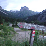
Day 9 - Briancon to Ceillac
Distance: 42km, Ascent: 2550m, Descent: 2160m, Time: 11h30m
Day 9, I was planning on leaving the Briancon Parc Hotel by 6am, but then realised the buffet breakfast was already set up, so stayed to get my money's worth, and didn't get away until 6:17am.
The first part of the GR5 leaving Briancon takes a rather pointless dogleg via an old water course to reach Villard St Pancrace, where you could have just walked up the obvious road.
Beyond Villard, the trail cut through forest to reach Chalets des Ayes, above which there was simply the most fantastic display of wild flowers. The trail climbed steeply to Col des Ayes, 2477m, with a steep rocky descent down the other side. There were some pretty dramatic limestone cliffs before Pra Premier, then a dirt road down to Brunissard which didn't seem to have much in the way of amenities. I kept going until Arvieux before collapsing in the shade for a quick lunchstop. The trail to Lac de Roue, 1854m, was a little tricky to follow, but after the marshy lake the trail entered wonderful old pine forest, and gave a nice shady descent to Chateau Queyras.
It was pretty warm as I crossed the river below Fort Queyras with all the white water rafters. The a long hot flog through the forest to Pre Faure, and then to a false col above Fontaine Rouge, which turned out not to be a col at all but a continuing rising traverse across some dramatic slopes mined and carved out for gypsum. When I finally reached Col Fromage 2301m, I was feeling fairly weary, and slumped on the ground and ate a few biscuits before getting stuck into the long descent to Ceillac, 1639m.
I was a bit nervous arriving at Ceillac, not knowing where the gite d'etape was, or whether it would have places, but eventually I found Les Baladins, and a cash point, and a small supermarket. The gite was busy, but I had a good sociable meal with some Spaniards from Tenerife.
View GR5 - Stage 9 in a larger map
 |
| GR5 - Day 9 |
Day 9, I was planning on leaving the Briancon Parc Hotel by 6am, but then realised the buffet breakfast was already set up, so stayed to get my money's worth, and didn't get away until 6:17am.
The first part of the GR5 leaving Briancon takes a rather pointless dogleg via an old water course to reach Villard St Pancrace, where you could have just walked up the obvious road.
Beyond Villard, the trail cut through forest to reach Chalets des Ayes, above which there was simply the most fantastic display of wild flowers. The trail climbed steeply to Col des Ayes, 2477m, with a steep rocky descent down the other side. There were some pretty dramatic limestone cliffs before Pra Premier, then a dirt road down to Brunissard which didn't seem to have much in the way of amenities. I kept going until Arvieux before collapsing in the shade for a quick lunchstop. The trail to Lac de Roue, 1854m, was a little tricky to follow, but after the marshy lake the trail entered wonderful old pine forest, and gave a nice shady descent to Chateau Queyras.
It was pretty warm as I crossed the river below Fort Queyras with all the white water rafters. The a long hot flog through the forest to Pre Faure, and then to a false col above Fontaine Rouge, which turned out not to be a col at all but a continuing rising traverse across some dramatic slopes mined and carved out for gypsum. When I finally reached Col Fromage 2301m, I was feeling fairly weary, and slumped on the ground and ate a few biscuits before getting stuck into the long descent to Ceillac, 1639m.
I was a bit nervous arriving at Ceillac, not knowing where the gite d'etape was, or whether it would have places, but eventually I found Les Baladins, and a cash point, and a small supermarket. The gite was busy, but I had a good sociable meal with some Spaniards from Tenerife.
View GR5 - Stage 9 in a larger map
 |
| Stage 9 - Briancon to Ceillac |
Friday, July 6, 2012
Day 8 - Refuge I Re Magi to Briancon
Distance: 43km, Ascent: 2060m, Descent: 2580m, Time: 12h30m
Day 8, I was up and away super-early, leaving Refuge I Re Magi at 5:48am in semi-darkness. Steep zig-zags, then easier trail lead to Col des Thures, 2194m, then after a short grassy descent I decided to take the scenic high-level GR5B trail, that picks up the Italian frontier, and briefly drops into Italy.
The trail through some quite wild and rocky terrain before reaching Col de Pertusa 2300m, where I descended back into France. The Chalets des Acles didn't provide a very inspiring lunchstop, so I just kept pressing on to the twin passes of Col de Dormillouse and Col de la Lauze. Descending towards Montgenevre, I was struggling to catch a hiker, until I realised the guy was running. So I needed to start running to close him down, we then jogged together down to Montgenevre where he went off in search of his friends who he seemed to have lost on the hill.
From Montgenevre to Briancon I didn't have any proper maps, so was really struggling to find the right trail, and made a bit of a faux pas by staying high on a mountain bike route, then took me into endless infuriating shallow zig-zags that were impossible to cut through impenetrable forest.
Eventually I exited these zig-zags, but there was still a bit of a hike to go before I reached the dramatic gorge and tiny bridge (Pont d'Asfeld) leading across to the fortified Cite Vauban towering over Briancon.
I dropped down to Briancon and found the first proper looking hotel: Parc Hotel pretty much right in the centre of the town. The hotel was expensive, but clean with a huge room, and I really didn't have the energy to hunt around for anywhere else, having been on the go for 12 and half hours.
View GR5 - Stage 8 in a larger map
 |
| GR5 - Day 8 |
Day 8, I was up and away super-early, leaving Refuge I Re Magi at 5:48am in semi-darkness. Steep zig-zags, then easier trail lead to Col des Thures, 2194m, then after a short grassy descent I decided to take the scenic high-level GR5B trail, that picks up the Italian frontier, and briefly drops into Italy.
The trail through some quite wild and rocky terrain before reaching Col de Pertusa 2300m, where I descended back into France. The Chalets des Acles didn't provide a very inspiring lunchstop, so I just kept pressing on to the twin passes of Col de Dormillouse and Col de la Lauze. Descending towards Montgenevre, I was struggling to catch a hiker, until I realised the guy was running. So I needed to start running to close him down, we then jogged together down to Montgenevre where he went off in search of his friends who he seemed to have lost on the hill.
From Montgenevre to Briancon I didn't have any proper maps, so was really struggling to find the right trail, and made a bit of a faux pas by staying high on a mountain bike route, then took me into endless infuriating shallow zig-zags that were impossible to cut through impenetrable forest.
Eventually I exited these zig-zags, but there was still a bit of a hike to go before I reached the dramatic gorge and tiny bridge (Pont d'Asfeld) leading across to the fortified Cite Vauban towering over Briancon.
I dropped down to Briancon and found the first proper looking hotel: Parc Hotel pretty much right in the centre of the town. The hotel was expensive, but clean with a huge room, and I really didn't have the energy to hunt around for anywhere else, having been on the go for 12 and half hours.
View GR5 - Stage 8 in a larger map
 |
| Stage 8 - Refuge I Re Magi to Briancon |
Thursday, July 5, 2012
Day 7 - Roc de la Peche to Refuge I Re Magi
Distance: 39km, Ascent: 2220m, Descent: 2370m, Time: 11h00m
Day 7 began by quietly slipping out of the shared room at Refuge Roc de la Peche, an early breakfast, then a cold dreich departure at 6:23am. Putting on sopping wet freezing cold North Face trail running shoes was not that comfortable. The early part of the trail was straightforward muddy landrover track Soon after passing the Refuge de Peclet-Polset I spotted several hikers ahead. They provided a useful target as the trail entered a section of large snowfields. I caught the final couple of hikers just before Col de Chaviere 2796m, the highest point on my route. The descent down the far side was pretty steep, but it was possible to descend rocks to the left of the snow. The angle quickly eased, and gave a pleasant route down to Polset.
After Polset the trail became steeper again as the route dropped down to Modane through forest, where I re-joined the GR5 (having been on the GR55 since Val Claret). I stopped for some picnic lunch in the centre of Modane beside the Hotel de Ville before climbing steeply out of the town across the railway and up a trail through the forest which popped out at the Sanctuaire Notre Dame Chapel. I then passed through the utterly deserted ski town of Valfrejus, before the long and not terribly inspiring drag up to Col de la Vallee Etroite, 2434m.
Luckily at this point, the scenery and ambiance took a major turn for the better, and the trail entered a section of perfect alpine meadows surrounded by rocky peaks. I hadn't 100% decided what I'd do when I reached Les Granges, since there were a couple of alternative routes choices (GR5B and GR5C) shortly afterwards. However just as I reached Refuge I Re Magi the decision was made for me, since the heavens suddenly opened and I got under cover just in time.
There was a very friendly atmosphere at the Refugio with the extrovert Italian staff. This valley was annexed from Italy into France after WWII, however the locals still quite clearly consider themselves to be Italian.
View GR5 - Stage 7 in a larger map
 |
| GR5 - Day 7 |
Day 7 began by quietly slipping out of the shared room at Refuge Roc de la Peche, an early breakfast, then a cold dreich departure at 6:23am. Putting on sopping wet freezing cold North Face trail running shoes was not that comfortable. The early part of the trail was straightforward muddy landrover track Soon after passing the Refuge de Peclet-Polset I spotted several hikers ahead. They provided a useful target as the trail entered a section of large snowfields. I caught the final couple of hikers just before Col de Chaviere 2796m, the highest point on my route. The descent down the far side was pretty steep, but it was possible to descend rocks to the left of the snow. The angle quickly eased, and gave a pleasant route down to Polset.
After Polset the trail became steeper again as the route dropped down to Modane through forest, where I re-joined the GR5 (having been on the GR55 since Val Claret). I stopped for some picnic lunch in the centre of Modane beside the Hotel de Ville before climbing steeply out of the town across the railway and up a trail through the forest which popped out at the Sanctuaire Notre Dame Chapel. I then passed through the utterly deserted ski town of Valfrejus, before the long and not terribly inspiring drag up to Col de la Vallee Etroite, 2434m.
Luckily at this point, the scenery and ambiance took a major turn for the better, and the trail entered a section of perfect alpine meadows surrounded by rocky peaks. I hadn't 100% decided what I'd do when I reached Les Granges, since there were a couple of alternative routes choices (GR5B and GR5C) shortly afterwards. However just as I reached Refuge I Re Magi the decision was made for me, since the heavens suddenly opened and I got under cover just in time.
There was a very friendly atmosphere at the Refugio with the extrovert Italian staff. This valley was annexed from Italy into France after WWII, however the locals still quite clearly consider themselves to be Italian.
View GR5 - Stage 7 in a larger map
 |
| Stage 7 - Roc de la Peche to Refuge I Re Magi |
Wednesday, July 4, 2012
Day 6 - Refuge Entre le Lac to Roc de la Peche
Distance: 42km, Ascent: 2060m, Descent: 2280m, Time: 11h50
A simple breakfast at Refuge Entre le Lac at 6am, and then away by 6:23am as the gardien was filling pails of fresh milk from his cows.
Today's stage passed right through the heart of the Vanoise National Park taking in some fantastic mountain scenery. The going was pretty straightforward as far as the Col de la Vanoise, but on the descent to Pralognan the sky turned black and it looked like we were in for a soaking. The rain showers passed, and in Pralognan I hurried to restock supplies and have a quick picnic before promptly heading out of town in the wrong direction.
It took my brain some convincing to follow the compass and head out of town in what felt like the same direction I'd come in. But eventually I found the track leading towards Les Prioux. And just in time for it to start absolutely pouring down with cold rain. I put my Goretex jacket on, but couldn't be bothered with overtrousers. The next section was along a water-logged forest track.
A few criss-crossings of the river, and eventually I was on the final climb up to Refuge Roc de la Peche. By this time the rain was really battering down and I was completely soaked and cold, so I was relieved to arrive and discover they had space, albeit a shared room with a French guy and his young daughter. That evening I had a good social meal with 2 Swiss couples from Brig who were hiking the Tour de la Vanoise.
View GR5 - Stage 6 in a larger map
 |
| GR5 - Day 6 |
It took my brain some convincing to follow the compass and head out of town in what felt like the same direction I'd come in. But eventually I found the track leading towards Les Prioux. And just in time for it to start absolutely pouring down with cold rain. I put my Goretex jacket on, but couldn't be bothered with overtrousers. The next section was along a water-logged forest track.
A few criss-crossings of the river, and eventually I was on the final climb up to Refuge Roc de la Peche. By this time the rain was really battering down and I was completely soaked and cold, so I was relieved to arrive and discover they had space, albeit a shared room with a French guy and his young daughter. That evening I had a good social meal with 2 Swiss couples from Brig who were hiking the Tour de la Vanoise.
View GR5 - Stage 6 in a larger map
 |
| Stage 6 - Refuge Entre le Lac to Roc de la Peche |
Tuesday, July 3, 2012
Day 5 - Plan de la Lai to Refuge Entre le Lac
Distance: 43km, Ascent: 2370m, Descent: 2050m, Time: 12h30m
I quietly crept out of the crowded dorm, and left the Plan de la Lai refuge at 6:39am. Damp, misty conditions gave way to dramatic cloud inversions as I climbed towards La Grande Berge. Soggy underfoot conditions to bypass grazing cattle at Lavachay meant I had soaking wet feet when I reached Col du Bresson (2469m). I removed my shoes and socks for while in an attempt to dry them out.
Below Refuge de la Balme, stretched out a long stony track which I attempted to run down. I missed a marker on the final descent to Valezan, and had to improvise to get back on route. By this time the temperature was really hotting up, and dropping down to Bellentre it was getting close to scorchio.
Disappointingly there was precisely nothing open in Bellentre, so I decided to cross the Isere river and head along the riverbank cyclepath to Landry.
However, when I reached Landry there also appeared, after much hunting, to be precisely nothing open either. I dropped into a grim little bar to get out of the sun, for a sit down and glass of Coke, and then started walking up the steep hill out of town. To my surprise, after only about a minute, I reached a campsite shop that for some strange reason was open. So I promptly stocked up, and had an impromptu picnic, allowing my shoes and socks to dry, before continuing into the heat.
The next section partly followed the main road, with a few short cuts through the forest. My plan had been to stop at Refuge de Rosuel (1556m), but when I got there I thought I might as well continue to Refuge d'Entre le Lac, which looked to be a far more dramatic and wild setting within the Vanoise National Park.
I arrived at the refuge too late for any food, so I just ate some bread and cheese and went more or less straight to bed.
View GR5 - Stage 5 in a larger map

 |
| GR5 - Day 5 |
 |
| Col du Bresson |
Below Refuge de la Balme, stretched out a long stony track which I attempted to run down. I missed a marker on the final descent to Valezan, and had to improvise to get back on route. By this time the temperature was really hotting up, and dropping down to Bellentre it was getting close to scorchio.
Disappointingly there was precisely nothing open in Bellentre, so I decided to cross the Isere river and head along the riverbank cyclepath to Landry.
However, when I reached Landry there also appeared, after much hunting, to be precisely nothing open either. I dropped into a grim little bar to get out of the sun, for a sit down and glass of Coke, and then started walking up the steep hill out of town. To my surprise, after only about a minute, I reached a campsite shop that for some strange reason was open. So I promptly stocked up, and had an impromptu picnic, allowing my shoes and socks to dry, before continuing into the heat.
The next section partly followed the main road, with a few short cuts through the forest. My plan had been to stop at Refuge de Rosuel (1556m), but when I got there I thought I might as well continue to Refuge d'Entre le Lac, which looked to be a far more dramatic and wild setting within the Vanoise National Park.
I arrived at the refuge too late for any food, so I just ate some bread and cheese and went more or less straight to bed.
View GR5 - Stage 5 in a larger map

Monday, July 2, 2012
Day 4 - Chamonix to Plan de Lai
Distance: 42km, Ascent: 2480m, Descent: 1730m, Time: 10h50m
I set my alarm for 5am with a view to reaching Les Houches by 7am and getting back on Schedule. I was hiking by 5:50am along the Route des Gaillands away from Chamonix. It was still fairly dark, damp and dreich with light rain falling.
I reached Les Houches at 7am and found a boulangerie-pâtisserie serving fresh pastries and coffee, and bought a copy of Le Dauphine to read about yesterday's football, Wimbledon and the Chamonix Marathon. I faffed around a bit in Les Houches trying to make sense of the GR5 signs, which pointed in the opposite direction of the route, sending me on a bit of a detour. But eventually picked up the obvious trail to Col de Voza (1650m) on the Tour du Mont Blanc. I caught up a French couple on the col and jogged down the other side with them for a while, before pressing on towards Les Contamines and not seeing them again.
I stopped briefly at Les Contamines for a few provisions before embarking on the long flog up to Col du Bonhomme in fairly murky weather. On the traverse after the col there suddenly seemed to be loads of people around, especially British and Japanese. I reached a crowded Refuge du Col de la Croix du Bonhomme early afternoon and decided to cancel my reservation and keep going to Plan de la Lai.
There was nice airy ridge along the Crete des Gittes, but when I reached Col de la Sauce the weather was turning very rainy and misty. Strangely hanging around in the mist were around 30 or 40 armed soldiers obviously practising some sort of military operation that involves standing around on a hill in the rain.
The descent was rather tortuous since the GR5 markers insisted on cutting all the corners, which took you down steep muddy overgrown little trails which were much more awkward than staying on the main track.
Luckily there was room at the Refuge Plan de la Lai, and I had social evening chatting with French and Dutch hikers.
View GR5 - Stage 4 in a larger map
View Refuge Plan de la Lai in a larger map
 |
| GR5 - Day 4 |
I reached Les Houches at 7am and found a boulangerie-pâtisserie serving fresh pastries and coffee, and bought a copy of Le Dauphine to read about yesterday's football, Wimbledon and the Chamonix Marathon. I faffed around a bit in Les Houches trying to make sense of the GR5 signs, which pointed in the opposite direction of the route, sending me on a bit of a detour. But eventually picked up the obvious trail to Col de Voza (1650m) on the Tour du Mont Blanc. I caught up a French couple on the col and jogged down the other side with them for a while, before pressing on towards Les Contamines and not seeing them again.
I stopped briefly at Les Contamines for a few provisions before embarking on the long flog up to Col du Bonhomme in fairly murky weather. On the traverse after the col there suddenly seemed to be loads of people around, especially British and Japanese. I reached a crowded Refuge du Col de la Croix du Bonhomme early afternoon and decided to cancel my reservation and keep going to Plan de la Lai.
There was nice airy ridge along the Crete des Gittes, but when I reached Col de la Sauce the weather was turning very rainy and misty. Strangely hanging around in the mist were around 30 or 40 armed soldiers obviously practising some sort of military operation that involves standing around on a hill in the rain.
The descent was rather tortuous since the GR5 markers insisted on cutting all the corners, which took you down steep muddy overgrown little trails which were much more awkward than staying on the main track.
Luckily there was room at the Refuge Plan de la Lai, and I had social evening chatting with French and Dutch hikers.
View GR5 - Stage 4 in a larger map
 |
| Stage 4 - Chamonix to Plan de la Lai |
View Refuge Plan de la Lai in a larger map
Sunday, July 1, 2012
Day 3 - Samoens to Chamonix
Distance: 38km, Ascent: 2500m, Descent: 2160m, Time: 11h10m
I set off from Hotel Le Gai Soleil at 6:42am, and stopped about a minute later to visit the boulangerie patisserie, which amazingly was open at 6:43 in the morning. I was then on my way following the Giffre Torrent. The weather was looking a bit iffy, with low cloud and intermittent rain. After crossing the river, the trail went through a dramatic little gorge - Gorges des Tines - with metal ladders and steps.
Cascade de Rouget, a huge waterfall, was the next dramatic feature. I stopped at Chalet de Lignon (1180m) for a few minutes, for a glass of Coke and to get out of the damp drizzly rain. The next section was into the mist, with a few breaks in the cloud before turning a corner into a wide area of alpage, backed by huge limestone cliffs. It was super-misty when I reached Chalets d'Anterne, and then started chucking it down with cold rain at Lac d'Anterne, just before I reached some long snow patches. This was all fairly grim and unpleasant. I passed over the Col d'Anterne 2257m and dropped down to Refuge de Moede Anterne, hoping to get some shelter and refreshment. However the hut was tiny and jam packed with other hikers, so I just sat outside in the cold and rain in shorts and T-shirt.
I didn't fancy stopping for long, knowing I was supposed to be traversing Le Brevent that afternoon. The descent to Pont d'Arleve was quite rough on a greasy rocky overgrown path. Once over the bridge the climb was at a steady gradient, but the weather suddenly got very unpleasant just as I reached the final snow patches to the Col du Brevent. It was hammering down with freezing cold, such that when I saw the 45 min sign to Le Brevent, I thought there's no way I'm going up there, and instead headed straight down to Planpraz, where in fact the Chamonix Marathon had finished earlier that day.
I was getting really quite cold and wet, so took some time under shelter to get organised. I then realised I had no idea where the trail down to Chamonix started. I'm not sure it was the best idea, but I ended up walking down Piste B10 "Nants", a steep but easy vehicle track that took a rather long-winded route to reach Chamonix.
I found a Gite d'Etape more or less at the trailhead, but lost my patience after waiting for about an hour for the gardien to arrive. The rain had eased off a bit, so I gathered up my stuff and headed down into Chamonix town centre. It was quite atmospheric walking through the start line of the UTMB with nobody around, and all the mountains shrouded in dark cloud. I turned right and headed along the familiar Chamonix main street (Rue du Docteur Paccard) past Snell Sports.
I realised now I'd made the correct decision to keep moving, since I could buy some provisions for the next couple of days, plus I could get a few km further down the road. I decided to check in at La Chaumiere where I'd stayed before my attempt at the UTMB in 2006. The place at obviously been refurbished to some extent since then. I hung all my wet kit in the room, then thought I might be able to order some food in time to watch some of the first half of the Euro 2012 cup final between Spain and Italy, however the restaurant service seemed to be based on Fawlty Towers, so I ended up missing the football, and was too infuriated to enjoy the food when it finally arrived.
I left the window wide open all night in the attempt at drying out all my wet kit, and could hear the rain as cars drove past.
View GR5 - Stage 3 in a larger map
 |
| GR5 - Day 3 |
I set off from Hotel Le Gai Soleil at 6:42am, and stopped about a minute later to visit the boulangerie patisserie, which amazingly was open at 6:43 in the morning. I was then on my way following the Giffre Torrent. The weather was looking a bit iffy, with low cloud and intermittent rain. After crossing the river, the trail went through a dramatic little gorge - Gorges des Tines - with metal ladders and steps.
Cascade de Rouget, a huge waterfall, was the next dramatic feature. I stopped at Chalet de Lignon (1180m) for a few minutes, for a glass of Coke and to get out of the damp drizzly rain. The next section was into the mist, with a few breaks in the cloud before turning a corner into a wide area of alpage, backed by huge limestone cliffs. It was super-misty when I reached Chalets d'Anterne, and then started chucking it down with cold rain at Lac d'Anterne, just before I reached some long snow patches. This was all fairly grim and unpleasant. I passed over the Col d'Anterne 2257m and dropped down to Refuge de Moede Anterne, hoping to get some shelter and refreshment. However the hut was tiny and jam packed with other hikers, so I just sat outside in the cold and rain in shorts and T-shirt.
I didn't fancy stopping for long, knowing I was supposed to be traversing Le Brevent that afternoon. The descent to Pont d'Arleve was quite rough on a greasy rocky overgrown path. Once over the bridge the climb was at a steady gradient, but the weather suddenly got very unpleasant just as I reached the final snow patches to the Col du Brevent. It was hammering down with freezing cold, such that when I saw the 45 min sign to Le Brevent, I thought there's no way I'm going up there, and instead headed straight down to Planpraz, where in fact the Chamonix Marathon had finished earlier that day.
I was getting really quite cold and wet, so took some time under shelter to get organised. I then realised I had no idea where the trail down to Chamonix started. I'm not sure it was the best idea, but I ended up walking down Piste B10 "Nants", a steep but easy vehicle track that took a rather long-winded route to reach Chamonix.
I found a Gite d'Etape more or less at the trailhead, but lost my patience after waiting for about an hour for the gardien to arrive. The rain had eased off a bit, so I gathered up my stuff and headed down into Chamonix town centre. It was quite atmospheric walking through the start line of the UTMB with nobody around, and all the mountains shrouded in dark cloud. I turned right and headed along the familiar Chamonix main street (Rue du Docteur Paccard) past Snell Sports.
I realised now I'd made the correct decision to keep moving, since I could buy some provisions for the next couple of days, plus I could get a few km further down the road. I decided to check in at La Chaumiere where I'd stayed before my attempt at the UTMB in 2006. The place at obviously been refurbished to some extent since then. I hung all my wet kit in the room, then thought I might be able to order some food in time to watch some of the first half of the Euro 2012 cup final between Spain and Italy, however the restaurant service seemed to be based on Fawlty Towers, so I ended up missing the football, and was too infuriated to enjoy the food when it finally arrived.
I left the window wide open all night in the attempt at drying out all my wet kit, and could hear the rain as cars drove past.
View GR5 - Stage 3 in a larger map
 |
| Stage 3 - Samoens to Chamonix |
Subscribe to:
Posts (Atom)